Hiking as a sport
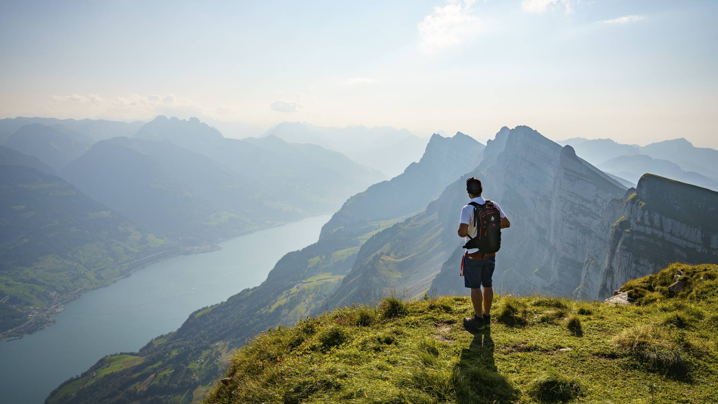
The Chäserrugg region has an impressive network of hiking trails spread over the meadows, alps and peaks of the Churfirsten. The different topographies and altitudes offer ideal conditions for different levels of training in the extensive mountain landscapes of Toggenburg.
The “Klassiker” (Classic Trail)
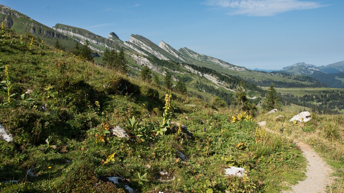
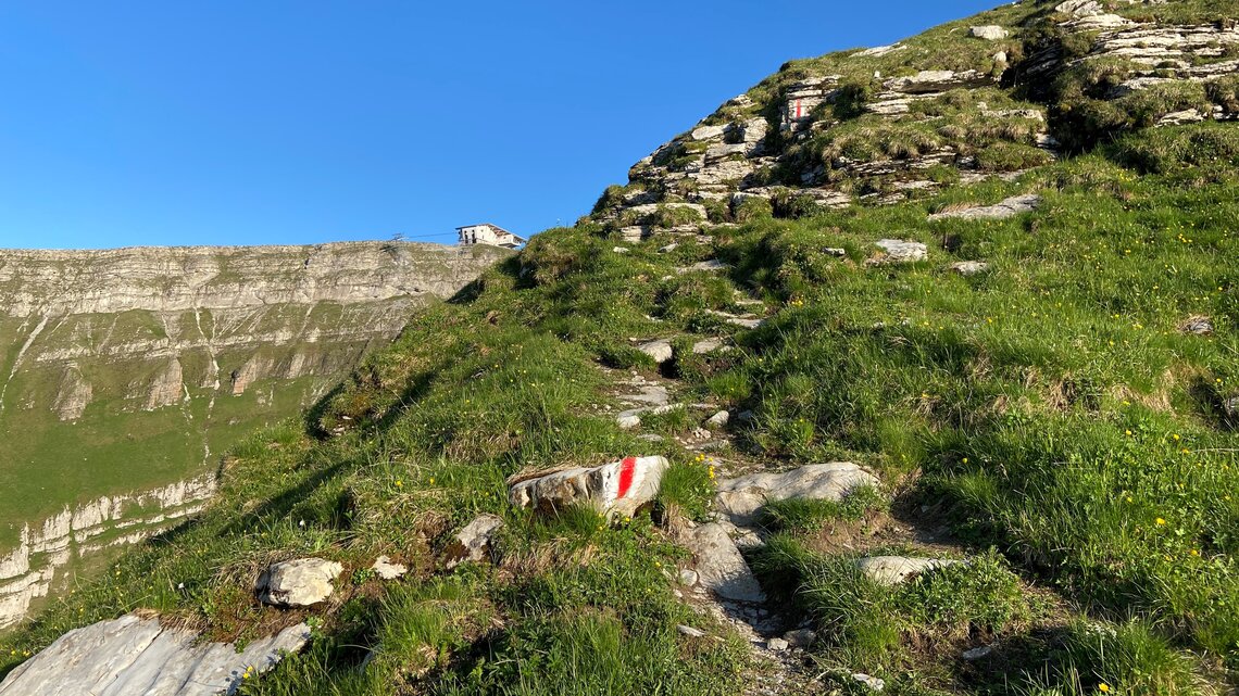
Climb to the summit without any major detours! After starting on the Iltios, the trail leads you steadily uphill across the pastures to the Surenboden. From there you follow the path that runs alongside the steep slope of the Stöfeli-Halde to the Stöfeli mountain inn. You then climb several stony steps on the sloping terrain and reach the Ruggschöpf after ascending a further 220 metres. From this point you tackle the last part of the ascent and hike along the ridge to the summit at 2,262 m above sea level.
This hike can also be extended by the “Geschenkter Gipfel” (Gift Summit) as well as a descent over the Hinterrugg and a hike through the Gluristal.
Facts
| Start | Iltios |
| Destination | Chäserrugg |
| Hiking time | 3 hours |
| Length | 6 km |
| Elevation | 912 m |
| Difficulty level | Medium (T2) |
| Amenities | Iltios mountain restaurant Chäserrugg summit restaurant |
| Highlight | The trail leads past the middle and mountain station of the Stöfeli lift by architects Herzog & de Meuron |
Price
Chäserrugg Ticket
Ascent and descent from the valley up to Chäserrugg
Adults with Half-fare /GA Travelcard
CHF 31.–
Adults
CHF 62.–
The “Morgenroute” (Morning Route)

In the light of the morning sun, you hike for 30 minutes from Alp Sellamatt via the Klangweg to Iltios. The hiking trail then heads south-east over the Surenboden and takes you to the lower part of the famous eastern descent.Now this interesting trail leads you along the impressive mountain flanks up to 1,900 m above sea level to Alp Plisa. Here a plateau with a fascinating karst landscape opens up before you. You cross this plateau on the marked paths, passing deep karst holes and crevices – the remarkable highlights of this hiking trail.
You now reach the last part of the ascent, an impressive scree field, over the Sattel. With some luck you will come across the ibex colony, which likes to retreat into the rocky cliffs here to enjoy the shade. After the scree field the final destination, the summit building by Herzog & de Meuron, is already in sight and you only have a short distance to go before you can indulge in the culinary delights of the summit restaurant.
Facts
| Start | Alp Sellamatt |
| Destination | Chäserrugg |
| Hiking time | 4 hours |
| Length | 9.5 km |
| Elevation | 959 m |
| Difficulty level | Medium (T2) |
| Amenities | Iltios mountain restaurant Chäserrugg summit restaurant |
| Highlight | Crossing the impressive karst fields |
An einigen Stellen erfordert die Route gute Trittsicherheit und kann teilweise rutschig sein.
Price
Chäserrugg Ticket
Ascent and descent from the valley up to Chäserrugg
Adults with Half-fare /GA Travelcard
CHF 31.–
Adults
CHF 62.–
The “Kaiserroute” (Emperor’s Route)
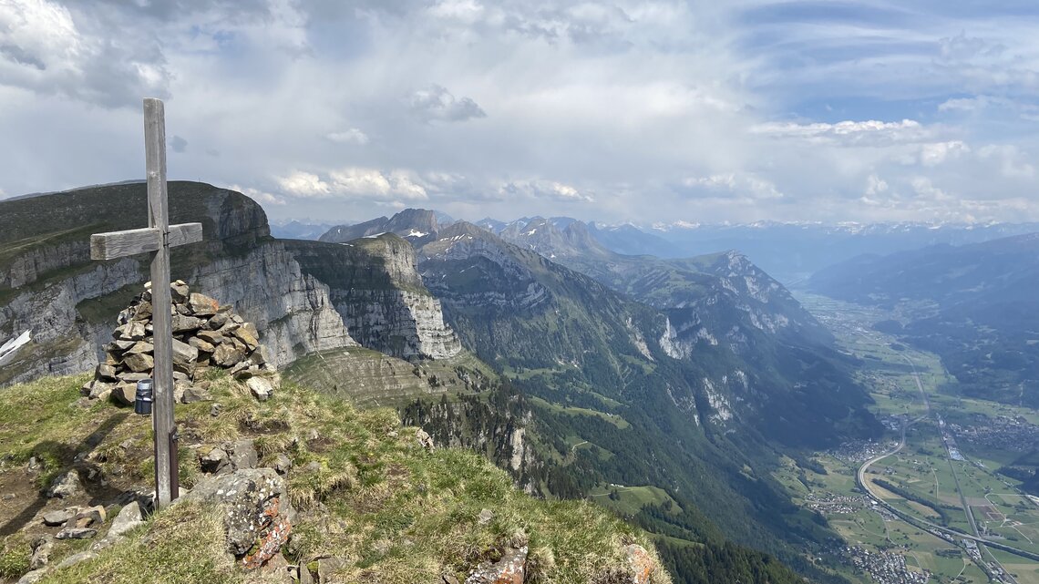
Only a few dare to take on the challenge of climbing all seven Churfirsten peaks in a single day. These intrepid hikers start early in the morning in Starkenbach (890 m), with the goal of reaching the Chäserrugg after an ascent of around 3,600 m and a route of almost 30 kilometres.
Finisher glass for Challenge participants on Peak Hunter
Take part in the Challenge 7 Churfirsten - Kaiserroute on Peak Hunter and receive the "finisher glass" with a drink on the Chäserrugg as a gift.
To do this, open the Peak Hunter app on your smartphone before the start of the hike and select the Challenge 7 Churfirsten - Kaiserroute. This way, each of the seven peaks will be registered and you will receive the well-deserved finisher's glass with a drink in the summit restaurant after completing the Challenge on the Chäserrugg.
Please note that the glass is only available on presentation of the completed challenge on the day of the hike during the opening hours of the summit restaurant.
The gentle start of the hike through the forest and over the lush grassy ridge to the first peak, the Selun (2,204 m), is the perfect start to this special day. The hike then continues towards the Frümsel (2,266 m); a steep spike, short but intense. Once at the top, it's time for breakfast with a unique view. In the far distance you can now already make out the day's destination, but the route first covers some exciting and varied peaks. The trail between the individual Churfirsten peaks takes hikers over impressive karst fields, past rock faces and peacefully grazing cows which exude a soothing feeling of calmness.
The wide ridge of the Brisi (2,277 m) is steep and long. If you are on touring skis in winter, you should definitely visit this peak when it is covered with snow. On the Brisi it is worth looking towards the west to the starting point of the hike. When this point is reached, half of the tour is already accomplished!
The second part of the hike is now somewhat more intense, but this is compensated by the constantly fabulous panorama. The sporty descent from the Brisi is the optimum way to prepare for the technically most demanding of all the Churfirsten – the Zuestoll (2,234 m). An Alpine hiking trail leads to its summit, and once at the top, the Selun is finally further away than the final destination, the Chäserrugg.
The trail up to the Schibenstoll (2,234 m) is long and strenuous. At the top you can enjoy the view with the comforting certainty that the last two Churfirsten only require one more ascent, thanks to a connecting ridge. On the way through the Gluristal towards the Sattel (2,045 m) you hike through unspoilt nature and may even see a few ibexes bathing in the sun. On your right the rock face of the Schibenstoll, which is 70 metres lower in altitude, always shows exactly how far it is to the summit of the Hinterrugg (2,306 m). In contrast to the Churfirsten you have already scaled, you can enjoy the view of the refreshing Walensee early on during the ascent to Hinterrugg. The closer you get to the second-last summit, the more majestic the views of the surrounding mountains become.
The summit building by Herzog & de Meuron is only a stone's throw away and you can really enjoy the "finish" from Hinterrugg to Chäserrugg. You have achieved what you set out to do and now belong to the elite circle of "Kaiserroute finishers".
Route
| Start | Starkenbach |
| Destination | Chäserrugg |
| Hiking time | approx. 12 hours |
| Length | approx. 30 km |
| Elevation | approx. 5,800 m |
| Difficulty level | Alpine hiking (T4) |
| Amenities | Chäserrugg Summit Restaurant |
| Highlight | Reach the Chäserrugg |
Only suitable for athletic and very experienced hikers.
Go to the Challenge on Peak Hunter
7 Churfirsten – Kaiserroute
Price
Descent Chäserrugg – Iltios – Unterwasser
Adult with HTX/GA
CHF 24.–
Adult
CHF 48.–
Frümseltal Hike
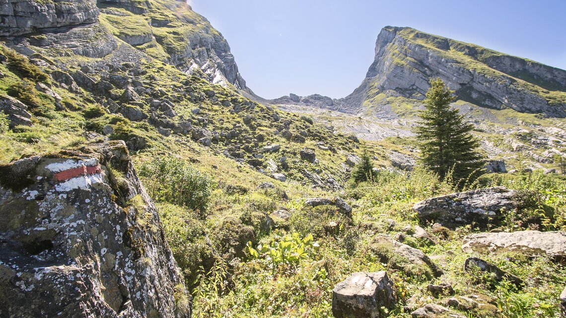
From Alp Sellamatt an interesting hiking trail takes you across meadows and pastures from Hinterlücheren to Brisizimmer. From there you hike to the foot of the Brisi before taking the hiking trail that meanders over hill and dale into the Frümseltal. During the ascent you have an impressive view of the rock faces of the Brisi and Frümsel and the large rock formations in between. At the end of the valley, after a demanding scree field crossing, a breathtaking view 1,600 m down to the Walensee awaits you. You can then hike back along the same route to the Zinggen or take a detour via the Thurtalerstofel.
Facts
| Start | Alp Sellamatt |
| Destination | Alp Sellamatt |
| Hiking time | 3.5 hours |
| Length | 10 km |
| Elevation | 650 m |
| Difficulty level | Medium (T2) |
| Amenities | Iltios Mountain Restaurant |
| Highlight | Viewpoint at the end of the valley with a view right down to the Walensee |
Price
Churfirsten Ticket
Ascent and descent on the lower section
Adults with Half-fare /GA Travelcard
CHF 14.50
Adults
CHF 29.–
The “Sportliche” (Athletic Trail)
After hiking from Alp Sellamatt to Zinggen, take the direct route to the steep forest trail to Oberruestel and follow it over the Sattel. The shepherd's hut with its fantastic view of the "Chammere" and the Gluristal is ideal to take a break and catch your breath. Afterwards you reach the Hinterrugg, the highest of the seven Churfirsten, on the hiking trail. From here you have a breathtaking view of the steep rock faces of the Churfirsten down to the Walensee.
After crossing the short connecting ridge you reach the Chäserrugg and can enjoy the culinary delights in the Herzog & de Meuron summit building.
Route
| Start | Alp Sellamatt |
| Destination | Chäserrugg |
| Hiking time | 3 hours |
| Length | 6 km |
| Elevation | 916 m |
| Difficulty level | Medium (T2) |
| Amenities | Chäserrugg Summit Restaurant |
| Highlight | Viewpoint at the shepherd's hut on the Sattel |
Price
Chäserrugg Ticket
Ascent and descent from the valley up to Chäserrugg
Adults with Half-fare /GA Travelcard
CHF 31.–
Adults
CHF 62.–
“Umweg, der sich lohnt” (Worthwhile Detour)

From Alp Sellamatt the trail leads you to Unterruestel, where you have two trail options; either to continue to Oberruestel and then into the Gluristal or to follow the path to Hinterlücheren, which also takes you into the Gluristal. The Hinterlücheren option is only recommended after a prolonged dry spell, as the path otherwise quickly becomes muddy and slippery. At the end of the Gluristal follow the mountain trail through a few turns up the stony slope to reach the highest of the seven Churfirsten, the Hinterrugg. From here you have a fascinating view of the Walensee and the surrounding mountains.
After a short walk you reach the Chäserrugg over the connecting ridge and can enjoy the culinary delights of the Herzog & de Meuron summit building.
Facts
| Start | Alp Sellamatt |
| Destination | Chäserrugg |
| Hiking time | 3.5 hours |
| Length | 6.5 km |
| Elevation | 916 m |
| Difficulty level | Medium (T2) |
| Amenities | Chäserrugg Summit Restaurant |
| Highlight | The path through the unspoilt Gluristal and the view during the steep ascent |
Price
Chäserrugg Ticket
Ascent and descent from the valley up to Chäserrugg
Adults with Half-fare /GA Travelcard
CHF 31.–
Adults
CHF 62.–

